Whistler’s Wildfire Past, part 2: Burned into the Landscape’s Memory
The Coast Mountain landscape is full of stories. You just need to know how to read them. The grandest of these tales recount violent clashes between volcanic lava and glacial ice, expressed through landforms such as the Table, the Barrier, and Black Tusk in Garibaldi Park. If you know what to look for, however, there are plenty of signs of past wildfire activity to be identified from our surroundings as well.
In the Whistler Valley, like most other populated valleys, the incidence of wildfires actually increased during the 20th century due to the large number of human-caused fires, especially those caused by railway activity. (Check out this blog post for some cool insights into railway fire suppression in the 1940s, not to mention Rainbow Lodge booze runs and the dangers of playing chicken with a freight train).
The point being, at any point in time, large swaths of our forests are in the process of recovering after a wildfire disturbance. Fire is an essential aspect of the life cycle of the Douglas Fir, the dominant tree species in our Coast Mountain valleys. They thrive under direct sunlight and grow fast and straight, allowing them to grow quickly after wildfires and clearcuts. They also have extra thick bark that acts like an armour against flame. This last point is crucial.
Even if only a handful of Douglas Firs survive a wildfire, these “resids” (short for residuals) are well-situated to re-seed the disturbed area and kickstart the forest’s regeneration. A few decades after a large wildfire, you will often find a few scattered, mature douglas firs surrounded by a uniform forest of younger growth.
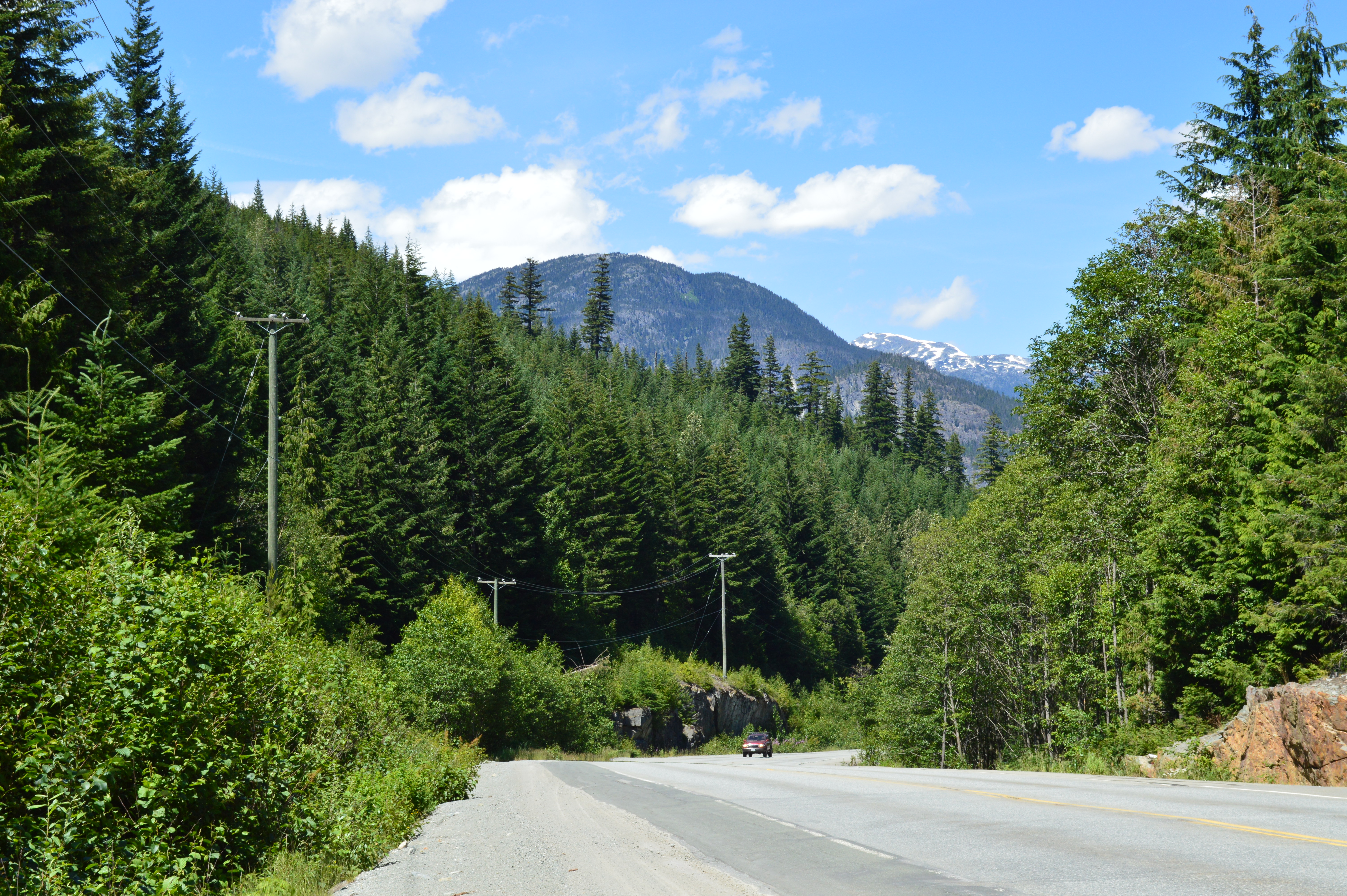
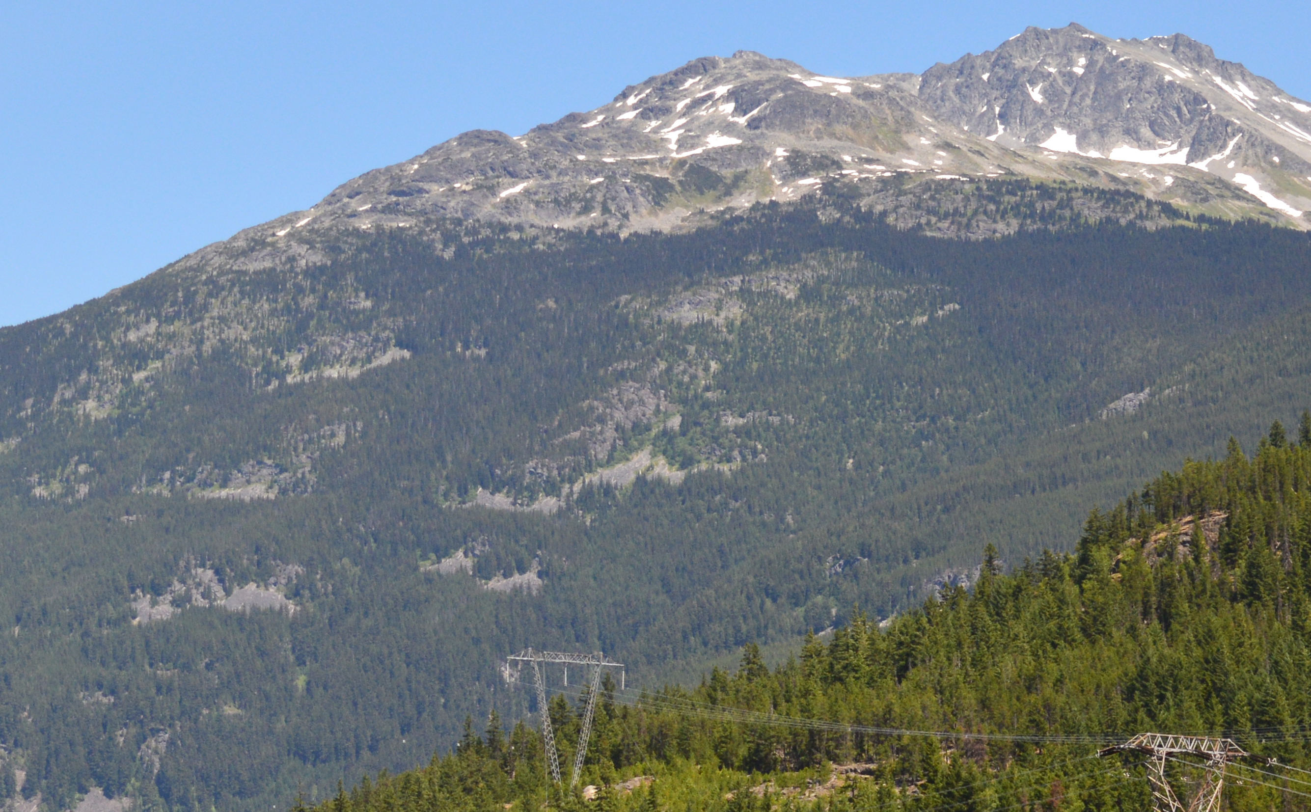
Heading north from Whistler on Highway 99, just before the Soo Valley turnoff, you can clearly see some trees that stand well above the rest of the forest. They are a few of the survivors of a massive wildfire from the mid-1920s that destroyed much of the surrounding forest.
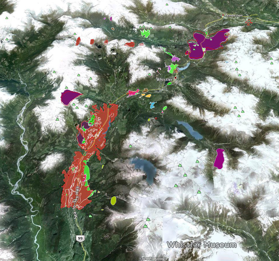
Checking back in with our wildfire data from the Whistler Forest History Project, there was a massive wildfire around the junction of the Soo River with the Green River in 1926. To fully appreciate a fire of this scale, you need a bird’s-eye view. Luckily enough, there is a lookout up the Soo Valley Forest Service Road that was designed with just this purpose in mind.
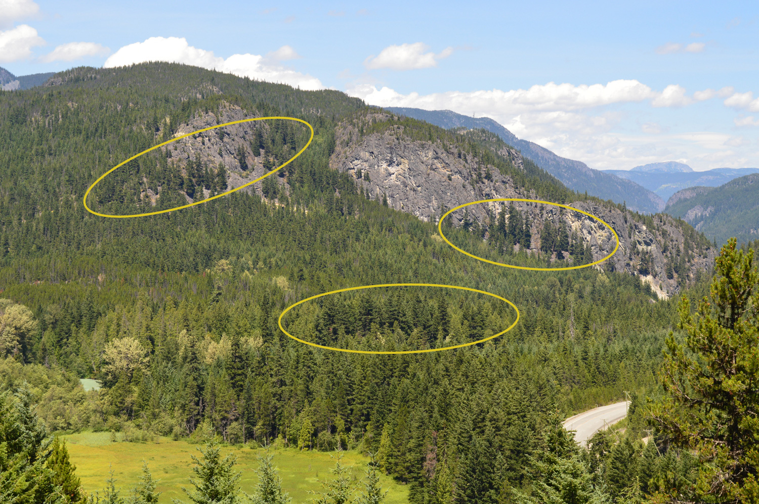
From this higher perspective you can see a few more groupings of residual douglas firs. Finally, looking across the highway at Mount Currie you can find the upper limits of this massive, historical fire. If the boundary lines were a bit straighter you might mistake them as the edges of old cutblocks.
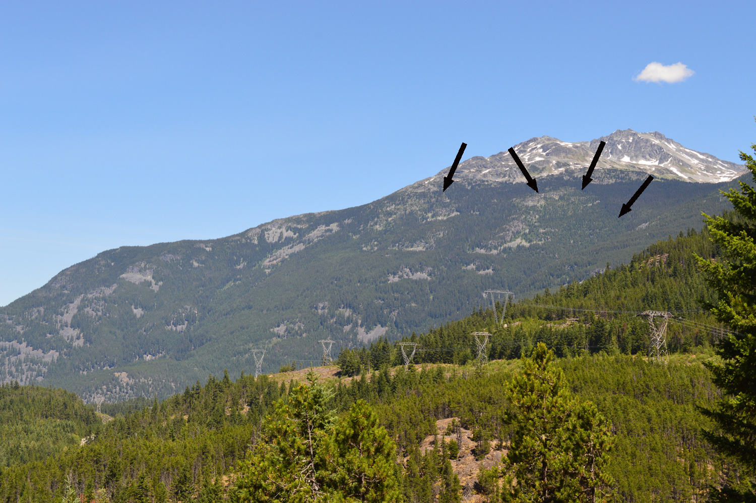
A close-up of the previous image.
Other prime spots for spotting past wildfire activity are Cheakamus Canyon and Pemberton Meadows (Tenquille and the Camel Humps, specifically). Anywhere else?
***
Much thanks to Rod Allen of the Pemberton Fire Base, and John Hammons of the Whistler Forest History Project for their help with this series of posts about wildfire history. Check out part 1 here, with more instalments to come throughout the summer.
For more of Whistler’s stories, check out the Whistler Museum’s blog.
Article source: http://www.whistlerisawesome.com/2013/07/13/whistlers-wildfire-past-part-2-burned-into-the-landscapes-memory/